Hawkesbury People & Places
Richmond Bridge
Bridge
Reference: p 18
Richmond Bridge was built by private subscription in 1860 and sold to the State of New South Wales in 1876 for 7 thousand pounds. A new concrete and iron bridge was opened in January 1904.
Source: NSW State Heritage Inventory
Reference: https://www.environment.nsw.gov.au/heritageapp/ViewHeritageItemDetails.aspx?ID=4309511
PLEASE NOTE THAT THE FOLLOWING INFORMATION IS NO LONGER AVAILABLE ON THE NSW STATE HERITAGE WEBSITE ABOVE
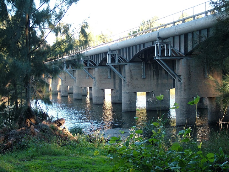
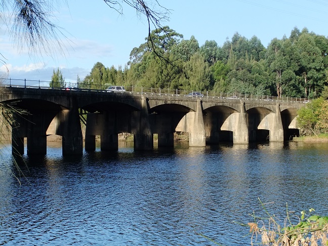
This bridge Monier concrete arch bridge of 13 spans, spans 2-12 of 16.45 m, spans 1 and 13 of 15.84 m. The superstructure is monolithic with the piers, which consist of two concrete caissons founded on rock, joined by a deep headstock with a curved soffit. The abutments are of the stone pitched spill-through type, founded on timber driven piles. A third column was added at each pier in 1926, supporting two riveted steel girders that were added to support a railway track for the Kurrajong Line which closed in 1952, but now support a widened road deck.
The structure is listed as a local and state heritage item and is one of the earliest surviving reinforced concrete road bridges in NSW. It is one of few concrete Monier arch bridges in Australia and probably the only one in NSW built between 1900 and 1948. It has technical significance due to its size and scale at time of building and position as the largest concrete arch bridge in Australia for twenty-five years, demonstrating the development of technological and engineering skills that were not repeated for another quarter of a century.
The bridge is important in the pattern of development of NSW’s cultural history. It has been an important item of transport infrastructure in the history of the Hawkesbury district for almost a century, ensuring continued ability to cross the Hawkesbury River at North Richmond at all times except for periods of excessive flooding. It ensured access to the interior via the Bell’s Line of road, the only alternative crossing of the Blue Mountains to the west of the Blue Mountains from the Sydney Basin for many years. The stability this has brought to transport movements in this part of the Hawkesbury Valley has made a significant contribution to the commercial and social development of the Valley. The bridge is an impressive and attractive structure, making a significant aesthetic and historical contribution to a historically rich landscape.

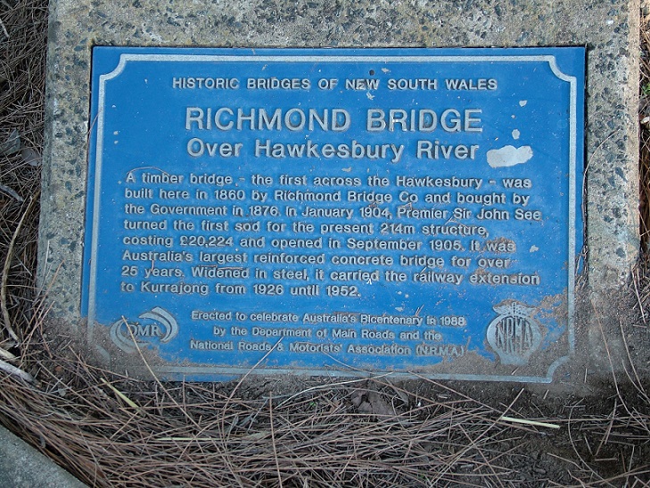
Plaque unveiled in 1988 by the NRMA and the Department of Main Roads. Cathy McHardy 2010

View of the bridge from the riverbank on the North Richmond side showing the structure which once supported the Kurrajong Railway Line, it also shows the water supply pipeline from North Richmond Water Treatment Plant. Cathy McHardy 2010

View of the bridge from the riverbank on the North Richmond side showing original concrete arch structures. Cathy McHardy 2010
Categories for Richmond Bridge
Related Locations of Richmond Bridge
You are welcome to add a comment, provide further information or suggest a correction, relevant to the history of this name.
Please make your comment below. PLEASE NOTE that comments are moderated and only relevant comments will be published
Property Research Service
Have you ever wondered when your house was built or who has owned your property over the years?
