Hawkesbury People & Places
Roberts Creek Road, East Kurrajong
Road
Roberts Creek Road runs in a north-south direction crossing Roberts Creek with a ford and linking Blaxlands Ridge with the Bull Ridge on East Kurrajong Road. Before the public road was constructed, a rough track through private property provided access to various farms along Roberts Creek.
For several years before the public road was put through, residents of Blaxlands Ridge had been lobbying the local member of parliament for the provision of a convenient route to East Kurrajong because to get between one ridge and the other it was necessary to travel along Blaxlands Ridge towards Kurrajong and then follow Comleroy Road to the intersection with East Kurrajong Road.
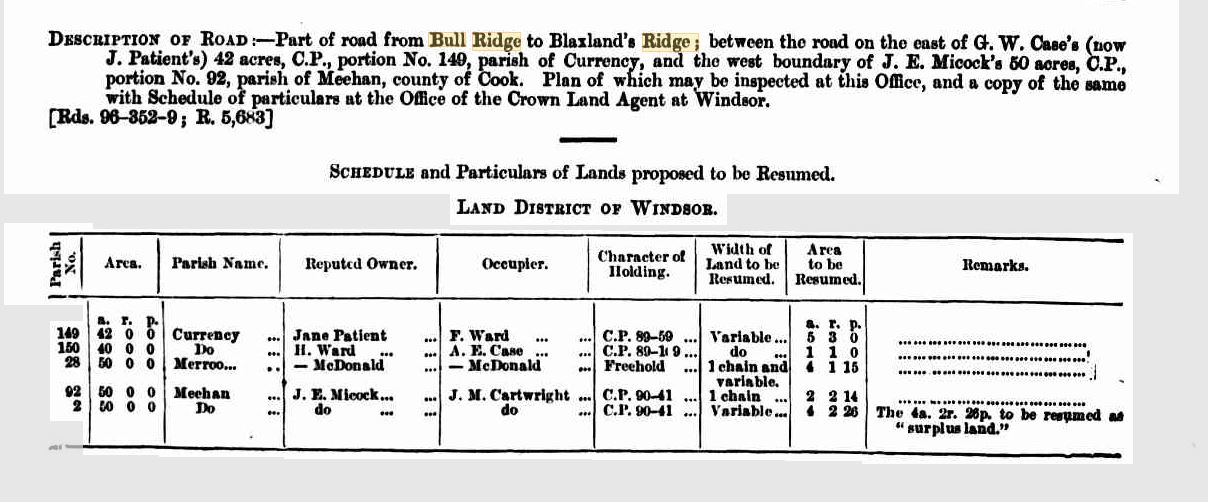
In February 1898 notice was given for the resumption of land on the southern side of Roberts Creek, the property occupied by George William Case to facilitate the construction of the public road. About 5 acres were required from Portion 149 and one acre from Portion 150, Parish of Currency, County of Cook. There have been minor changes to the alignment of the road over the years but the route still follows the original route constructed around 1900.
New South Wales Government Gazette, Wednesday 16 February 1898 [Issue No.139 (SUPPLEMENT)] Page 1253 - NOTIFICATION OF RESUMPTION OF LANDS UNDER THE PUBLIC ROADS ACT OF 1897.
Location of Roberts Creek Road
Categories for Roberts Creek Road
Related Locations of Roberts Creek Road
You are welcome to add a comment, provide further information or suggest a correction, relevant to the history of this name.
Please make your comment below. PLEASE NOTE that comments are moderated and only relevant comments will be published
Property Research Service
Have you ever wondered when your house was built or who has owned your property over the years?

